11/28/13; 6 miles; Whiskeytown National Recreation Area
Today was an interesting day. We woke up early to get an early start on our drive to Whiskeytown. Of the four waterfalls in the park, I had wanted to hike to Boulder Creek Falls. The road to the trailhead was worrisome, as it was rocky and had a few steep parts where I had to drive extremely slow. A little after we parked, a woman drove up in a SUV from the opposite direction, and I asked her how the road was coming from that direction, and she said it wasn't steep (but for my car, there was a steep part, but not as bad as the road we took in.) We told her we were also heading to the waterfalls, and she got a head start while we were still getting ready to leave the car.
Along the way, during a break, I accidentally knocked my camera from the backpack strap, and it fell to the dusty rocky trail. I couldn't tell if the body or lens got damaged, so I was kind of bummed for the rest of the hike. And I didn't get to take photos of the waterfall. Not because of my camera, but because we went the wrong way. We didn't have a map, and even if we did, it only showed one trail, so when we came to a fork, with a big arrow constructed of large sticks pointing in one direction, we naturally went that way. After hitting the turn-around mile mark, and after some very steep descents (which kept on going), we decided to turn around and head back to the car. Upon returning to the car, we found a note from the woman in the SUV, asking us to call her because she was worried about us, since we didn't cross paths to the waterfall. That made us smile. Thank you kind lady!
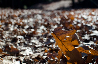 |
| Lots of leaves on the trail |
 |
| This is the note the woman left on my car! |
11/29/13; ~4 miles; McArthur-Burney State Park
After testing my camera last night, it seemed to have miraculously survived the fall.
 |
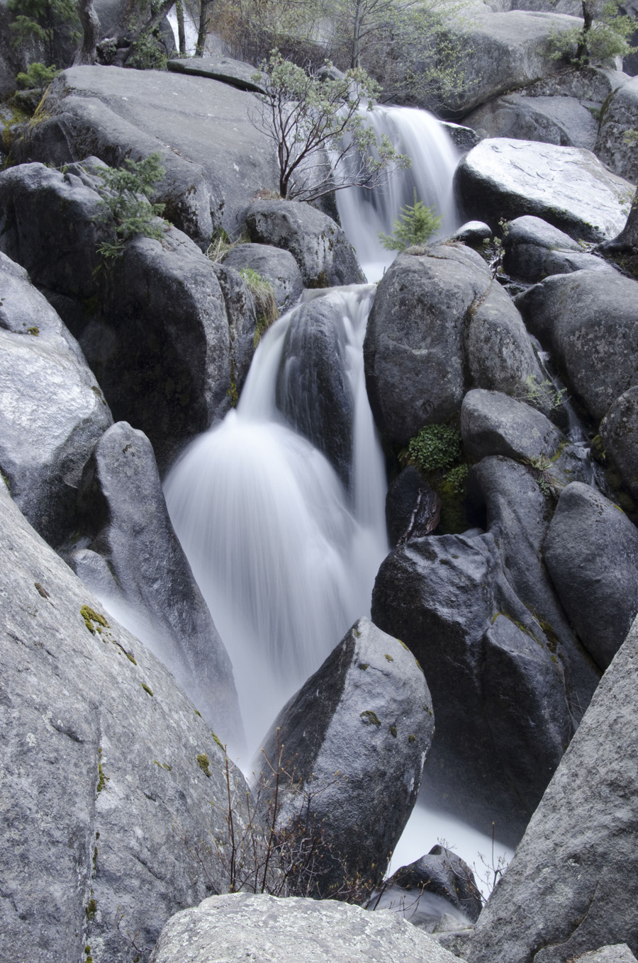
| Mist from the falls filled the air |
 |
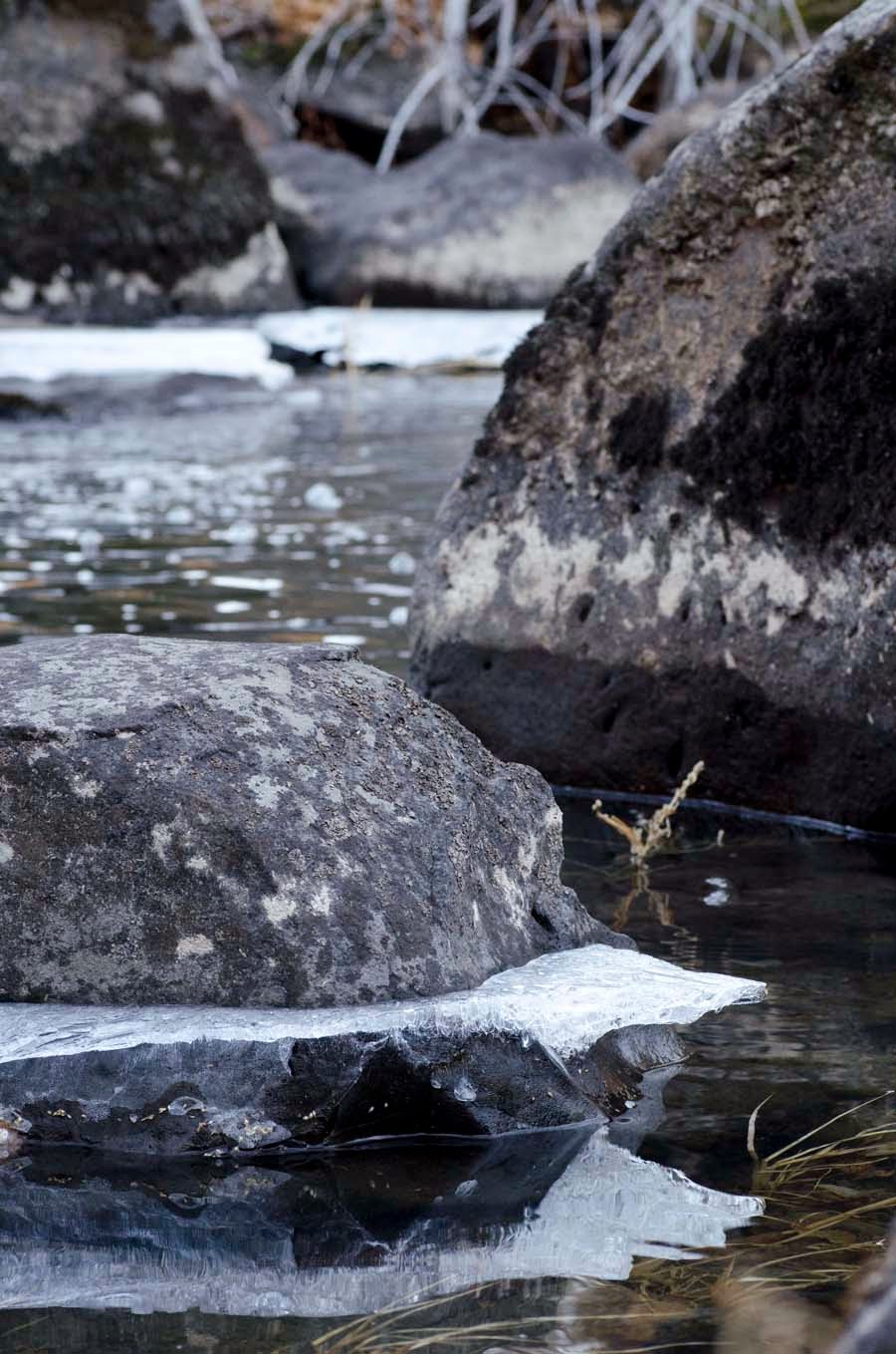
| We were so excited to see parts of the river frozen over |
11/30/13; Castle Lake to Heart Lake
There are two ways to get to Heart Lake; one way follows a trail past a posted "Private Property" sign, the other way requires a scramble up rocky and bushy terrain.
Not wanting to trespass (though there are no barriers, only a sign, and most trail descriptions state to go along this path), we decided to attempt to go along the adventurous way. We followed the trail along the lake, until we came upon the base of a cliff, where the trail seemed to end. Not seeing a possible way around, we decided to head back to the car. There we saw a couple with a book, the only book or guide I've come across that says to go the way we went. It said to go up a steep scramble. As the couple left for their hike, we decided we would try to go that way too, noting that we had seen a portion of the hill that kind of looked like a trail, but dismissed it as an area that had a rock slide. When we got to the base of the rocky "trail", we saw the couple had gotten to an area that required having to go through thick shrubs. Having two dogs, they had to turn back and try a different route. When we got to the shrubs, we decided to turn around and head back to the car, for the second time. After a quick trail lunch, we finally decided we would go the other route, as there were more than a dozen cars, and we had only seen two couples attempt to go the way we went previously.
 |
| At the end of the first attempt, the trail ended at these plants. |
 |
| Castle Lake |
 |
| The scar in the hillside was the rocky scramble we attempted |
 |
| A frozen Heart Lake |
 |
| View of Mt. Shasta standing on Heart Lake |
 |
| Castle Lake with Mt. Shasta in the background |
12/1/13; Lake Shasta Caverns


